
Late evening, a small café on Lombok, a hot mocha. I was trying to get warm and reading other people’s accounts of the climb, and slowly realising that this time I had overreached. Ten hours uphill, frost at the summit, a vocabulary of curses. I closed the reviews before I started laughing at myself. There was no going back.
Lombok had surprised me from the moment I left the airport. After Bali it felt almost uninhabited: rice and maize fields instead of terraces, low palms, long tidy roads with hardly a house or an oncoming car. Then the driver pointed out of the window. “Rinjani, Olga.” Only the top showed above the cloud, and even that was enough. It looked nothing like Merapi, the scowling volcano I had met on Java. This one was an aristocrat.
The mountain
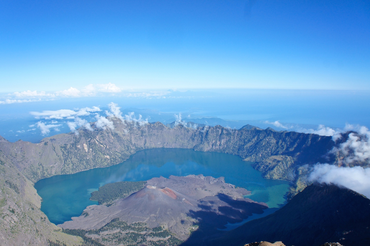
Mount Rinjani rises to 3,726 metres, the second-highest volcano in Indonesia after Kerinci on Sumatra. A huge eruption long ago collapsed part of the mountain into a caldera, which filled with water to become Segara Anak, a crater lake about 2,000 metres above the sea. The summit is the peak on its eastern rim. Inside the lake, a young cone called Barujari has grown out of the water. When I was there it smoked and grumbled quietly; within a few months of my climb it erupted, sending lava into the lake.
The climb is not Everest, but it is genuinely hard. Before anything else, decide how far you want to go.
Choosing the route
Most trekkers stop at the crater rim, around 2,640 metres, where the camp looks down on the lake and Barujari, then descend to the lake and its hot springs. Only a small number go on to the summit, and that last stretch is a different order of effort. Once you start up from the rim, everything below feels like a warm-up.
There are two classic starting villages. If the summit is your goal, start from Sembalun. The path is longer but gentler at first, across fields and modest slopes, while the Senaru side climbs steeply from the beginning. From Sembalun you camp on the rim and go for the summit before dawn on the second morning, while you still have strength. From Senaru the lake comes first, and the summit waits until the third day, when your legs have much less left to give. It is also far more pleasant to soak in the hot springs knowing the hardest part is behind you.
I planned three days from Sembalun. The mountain kept two.
The easiest part
Before we set off, I was sent to the far end of Sembalun to register. A large ledger lay open in a little office “just in case anything happens”, which was an encouraging start. I leafed back through the pages and found mostly names from Southeast Asia.
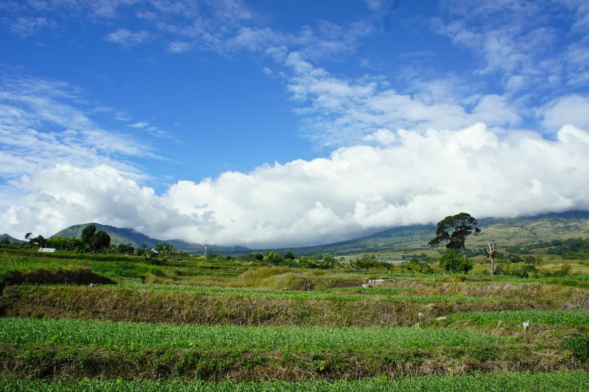
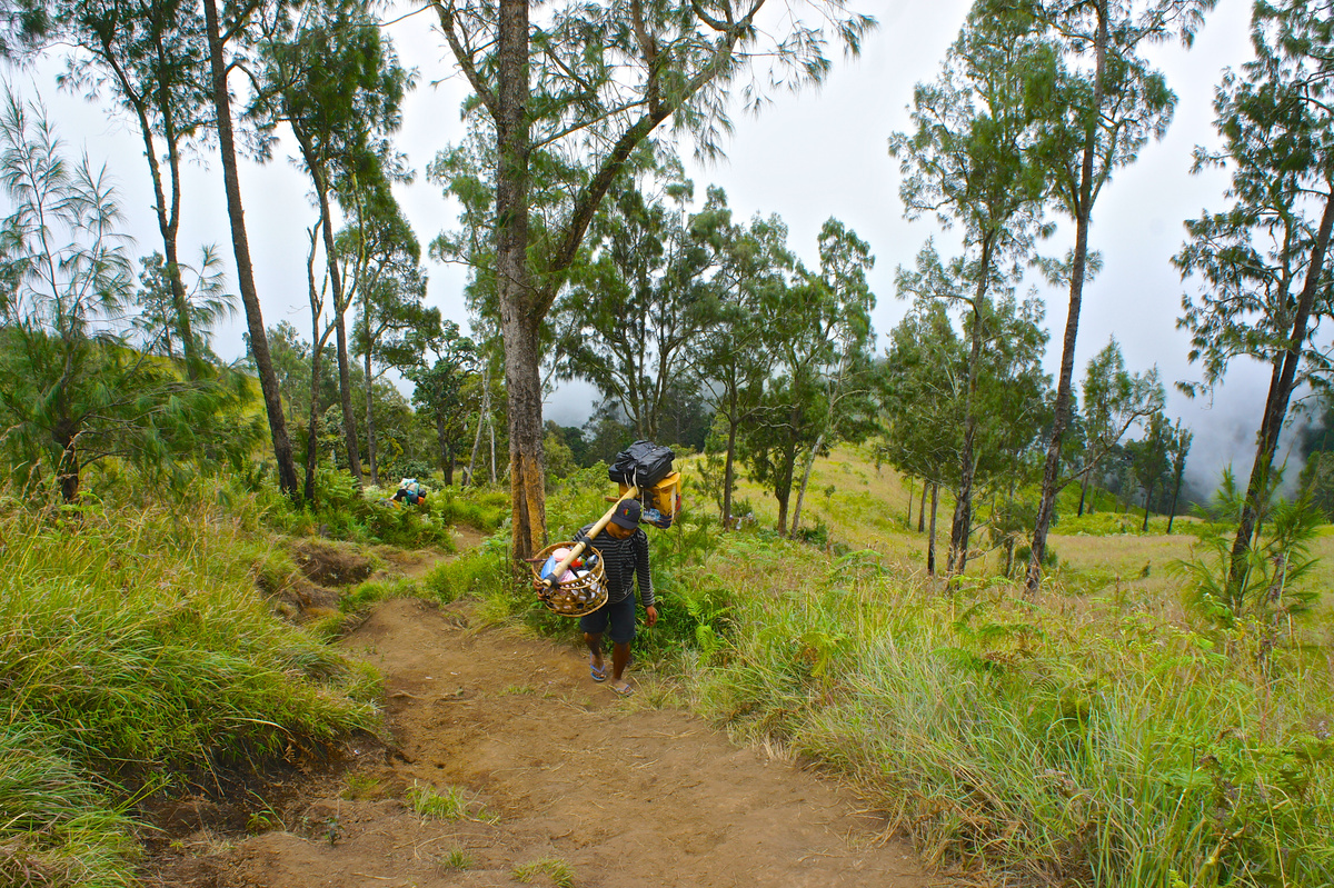
Our team was three: Fandi, a quick and cheerful guide whose name I kept forgetting at exactly the moments I needed it; a porter who carried around thirty kilograms of tents, food and water in two baskets on a pole and was always ahead of us; and me. We started at nine in the morning, strolling through rice and maize. Within two hours my ears were ringing and my red trainers looked green. Fandi glanced at my face and called back: “Let’s go faster. This is the easiest part.” That was when I understood what I had signed up for.
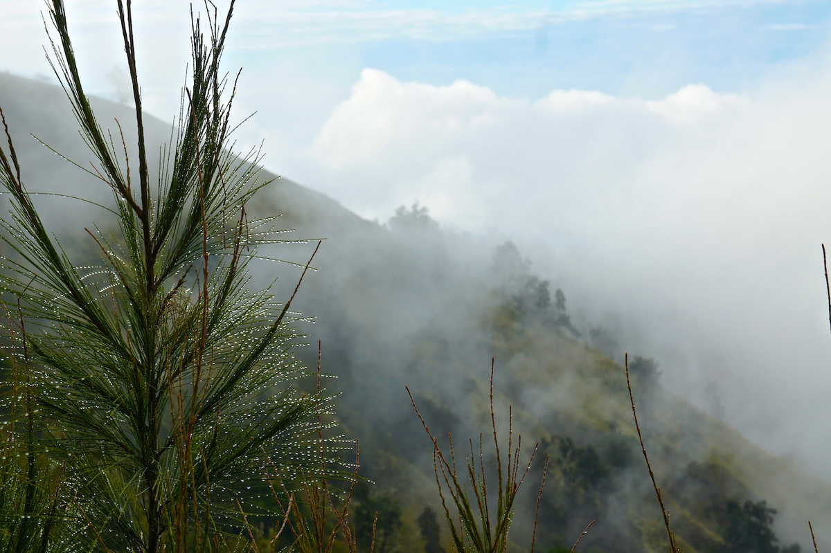
Then we walked into the clouds. I had always wanted to, and it was a remarkable moment, though the world inside them was grey, silent and damp. Lone pines stood about like mourners. Moving made me hot, but the cold air would not let me take off my jacket, so I climbed in it and suffered.
We stopped for lunch just as rain began. The men found shelter, made a fire and improvised a table, plates and shelves out of whatever lay around, like children building a house in a game. After lunch the path rose at a steady forty-five degrees over roots that served as stairs. A troop of monkeys watched us pass. They were perfectly polite; one seemed to be asking whether we were sure.
Sunset on the crater rim
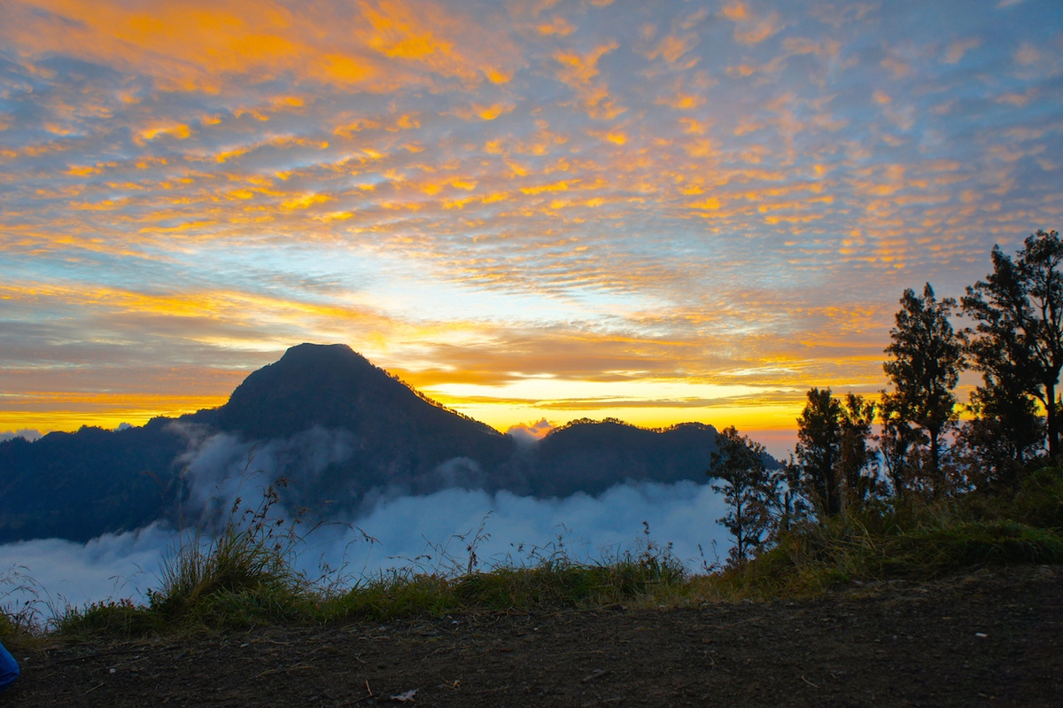
We reached the ridge at sunset, after about ten hours of climbing. Behind us the clouds lay below the pass. In front, the lake sat in its caldera under a lid of cloud, and the sun was sliding behind the mountains. I ran ahead to catch it, photographing until the light was gone and my fingers would barely hold the camera.
The last half hour to camp in the dark did its worst. By the time I saw the tents I could not feel my hands. I put on every layer I had and went to the fire, and before I could ask for tea, Fandi handed me a cup with cinnamon and ginger. Five minutes later came a soup so dense with local herbs and spices that at sea level I could not have swallowed a spoonful. Up there it was exactly right. Within minutes the warmth had spread through me.
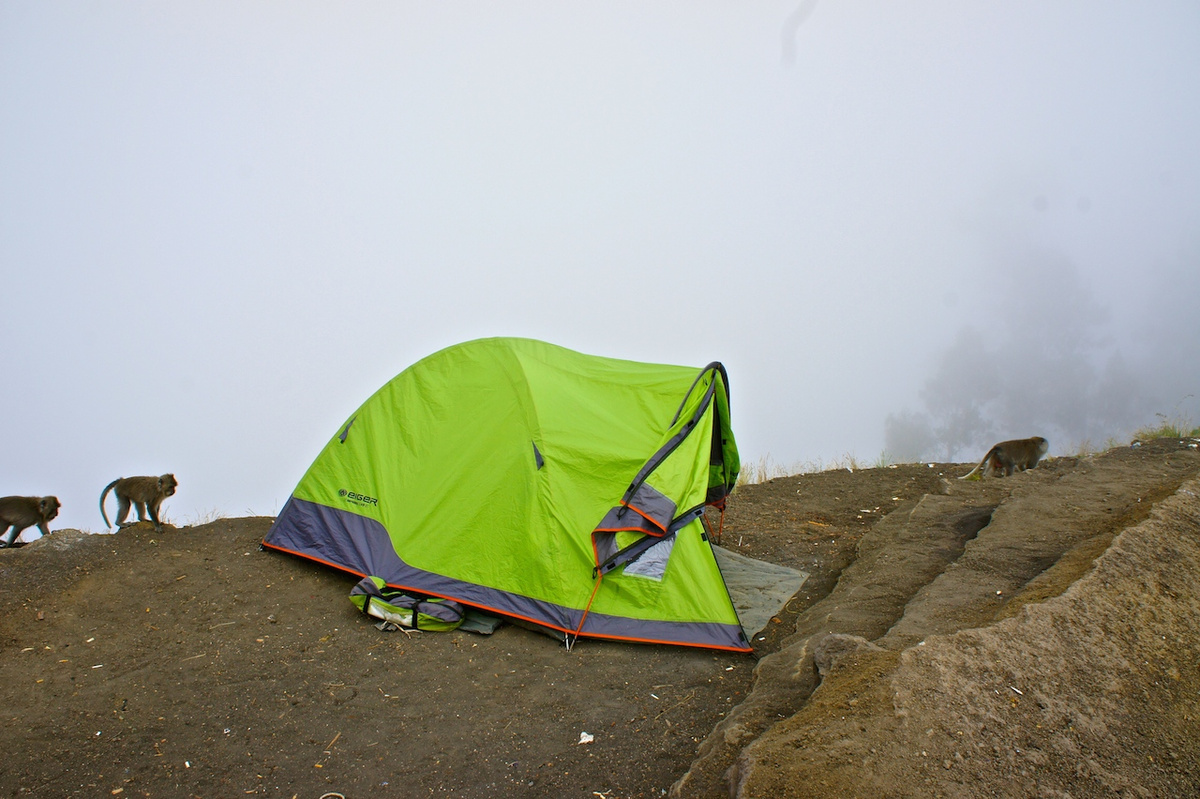
I lay in the tent where I could see the stars and an enormous, nearly full moon. I dozed, then woke to sounds outside. Something was at the foot of the tent; then more of them gathered at the entrance, and I heard a low growl. I told myself firmly that these were dogs, without asking what dogs would be doing at 2,639 metres. The next day Fandi mentioned, in passing, that I should keep my shoes inside the tent. In daylight the answer was standing beside it.
The summit before dawn
We left at two in the morning, Fandi and I, after hot tea and biscuits. He checked that I really meant the summit; most of his clients were content with the rim and the lake.
The summit push comes in three parts. First, a near-vertical slope of roots and loose stones, climbed in the dark, where I needed both hands and holding a torch became a nuisance. For the first time I thought: what if I simply stop here? The sunrise would be beautiful from this spot too. Then the slope eased onto a long ridge, the only chance to rest and gather what strength remained. As it grew light, the lake appeared below, sombre at first, then clearer as the clouds drifted off it.
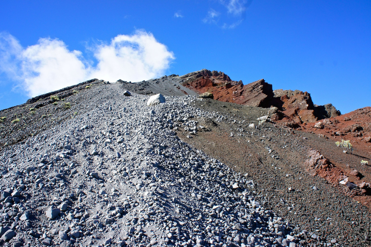
The last part is about a kilometre of loose volcanic gravel along the edge of the drop. Two steps up, one slide back. The summit refused to come closer, and I stopped looking at it. Lack of oxygen, cold that locked my fingers, exhaustion, my aching feet: all of it arrived at once. Agung on Bali appeared on the horizon, and the Gili Islands, and the whole of Lombok. I was racing the sunrise and lost, but only just. About four hours after leaving camp, I reached the top.
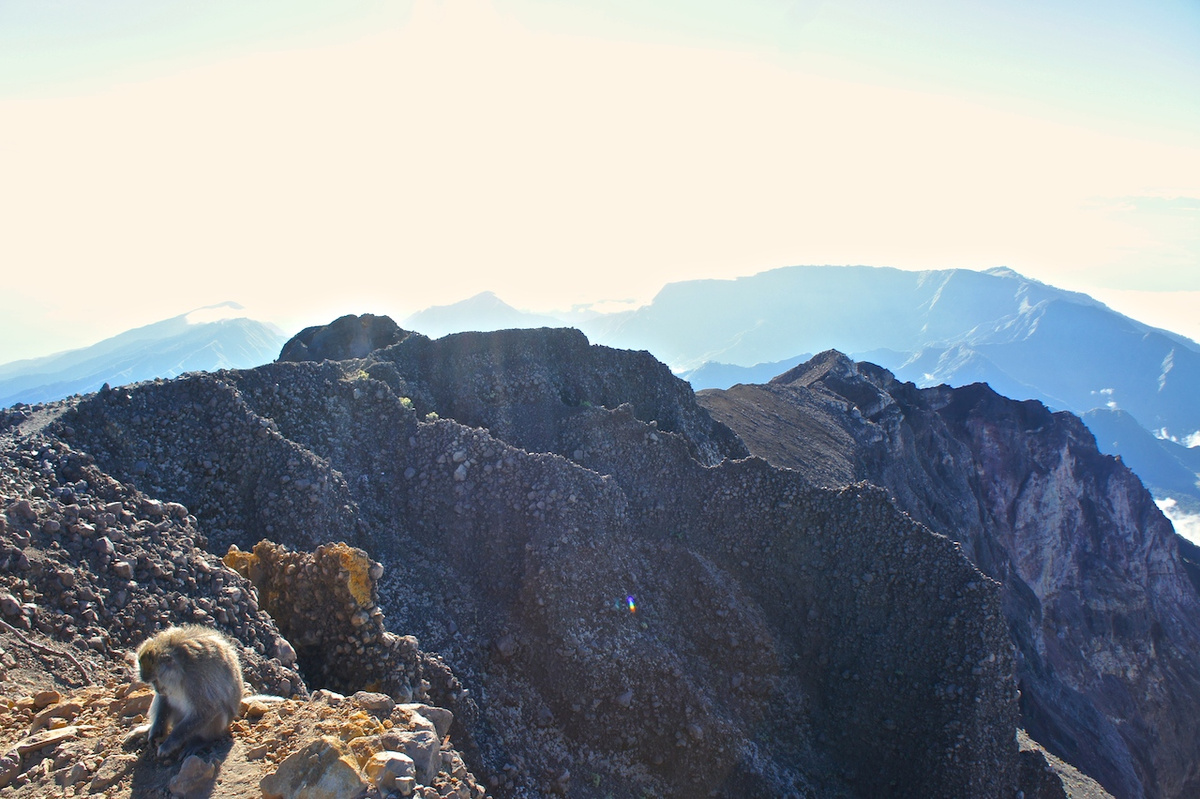
I had imagined jumping for joy up there. In fact the flat ground on the summit was no bigger than a square metre or two, and my strength was truly gone. I sat down on a rock, took off my backpack and closed my eyes. What I felt was simple, complete happiness, the first moment of pure joy since the climb began.
The sun came up, I warmed through, and I opened a packet of nuts. Then something shoved me from behind. A large monkey was standing next to me. At 3,726 metres, my first thought was that tiredness had finally broken my mind, so I did not move until it leapt at my backpack. Then we were both on the edge of the drop, tugging the bag between us. A packet of biscuits fell out and saved me. The monkey dropped the bag, grabbed the biscuits and gathered every crumb while keeping an eye on me, ready to run. It made me laugh so much that I would not have taken them back for anything.
The way down
After about an hour I started down, reluctantly. The steep first section, the worst on the way up, was the easiest on the way down: I apologised to my trainers and ran, sliding down the river of stones like a child in puddles. Within an hour we were back at camp for breakfast. The lake was down there with Barujari still smoking quietly, but I had already collected several layers of the mountain on myself and decided to admire the hot springs from above.
The real price of my game on the scree arrived later. Small stones had filled my trainers and rubbed my feet raw, and on a descent all the weight goes onto the toes. The walk down, meant to take five hours, stretched into something I still remember as endless. Darkness fell before the forest. Fandi slipped a knife into his pocket and I did not ask why. Near the end I fell into a maize field twice for no reason at all, and laughed so hard that he stopped worrying. The full moon that had kept us company all those days came up again, with Rinjani behind us and the sound of the mosques ahead. Then Fandi turned around, smiling: “Remember?” It was the easy first slope. “Thirty seconds… twenty seconds,” and there was the bench where, an age ago, we had packed our things.
About twenty-five kilometres in all, roughly twelve of them uphill; thirteen hours of climbing to the summit. It was the hardest journey of my life, and I am endlessly glad I made it.
What I would tell a friend before Rinjani
Shoes matter most. This was my great mistake, and the reason two days replaced three. Wear proper, well-tested trekking boots that do not pinch the big toe on the descent and do not let gravel in near the summit. Even flip-flops would have served better than my trainers on the lower path. I lost both big toenails and could not wear closed shoes, let alone climb, for three or four months.
Dress for two climates. By day it is humid, cool and often raining; in a jacket you overheat, without it your wet shirt chills you. A long-sleeved cotton top and cropped trousers would have been ideal. From sunset to sunrise it is truly cold, below freezing on the summit: bring a hat, gloves, a warm scarf, a wool jumper, a jacket and a rain poncho. Pack swimming things and a towel if you are going down to the hot springs.
Do not economise on the trekking company. I love independent travel, but here it only wastes strength you will need: tents, sleeping bags, three days of food and water all have to go up the mountain. Choose a price above average. The difference shows in the food, the tents, the extra blanket that was anything but extra, the hot tea that appeared when I started turning blue, the bag of nuts at exactly the right stop. My trip was private, with one guide and one porter, and I was glad every day that I had not skimped.
Carry the small things. A head torch rather than a hand-held one, a power bank, a first-aid kit and wet wipes, which proved invaluable. And bring determination. A strong enough intention can make up for a shortage of strength.
Check the rules before you plan. Climbing permits are booked through the Mount Rinjani National Park’s eRinjani system, usually by your trekking company, and numbers are limited. The trails close for the rainy season, from January to March in 2026, and the park can suspend new bookings at short notice. Confirm the current position with the park or your operator before fixing flights.
Indonesia’s great treks, after Rinjani
On the summit, with Agung floating above the clouds across the strait, I understood that Rinjani is a single vertebra in a long volcanic spine. Indonesia counts 127 active volcanoes, and its multi-day walks fall into four kinds: up live volcanoes, up high mountains, into remote cultures and through jungle. Here is how I would choose among the best of them.
Fire mountains
Merapi, above Yogyakarta, is the country’s most restless volcano. I rode to its foot through villages rebuilt in its ash, and even wrapped in cloud it felt alive. It is a mountain to respect from its slopes.
Bromo, in East Java, is the most famous sunrise in Indonesia, and the jeep convoy to the Penanjakan viewpoint shows it. Sleep at Cemoro Lawang on the caldera rim instead, walk up to Seruni Point in the dark, then cross the Sea of Sand to the smoking crater after the crowds have gone. A stairway of around 245 steps climbs the last stretch to the rim, where you look straight down into the vent. Overland between Java and Bali, Bromo is the stop that turns a long transfer into a journey.

Ijen belongs on the same route, near Banyuwangi and the ferry to Bali. The night climb leads to a turquoise acid lake so improbable it looks painted, and to the men who still carry sulphur out of the crater on their shoulders. The famous blue flames are fainter than old photographs suggest; go for the lake at dawn, and take a proper gas mask rather than a cloth one.
Agung, at 3,031 metres the highest point and holiest mountain on Bali, is the climb I would give a fit friend with one free night. From Pasar Agung it takes three or four hours to the crater rim; from Besakih, six or more to the true summit. Both start in the dark for sunrise. Go with a licensed local guide, and remember that the Besakih route closes for the great temple ceremonies. The mountain was in eruption between 2017 and 2019, so its status deserves a check before you plan around it.
Krakatau, in the Sunda Strait between Java and Sumatra, is the name everyone knows. Its child, Anak Krakatau, partly collapsed into the sea in 2018, and in October 2026 it was back on high alert, with visitors kept five kilometres away. For now it is a volcano to admire from a boat, not from its slopes.
Kelimutu, on Flores, is the gentlest of all: a short walk from the car park to three crater lakes that change colour over the years, from turquoise to deep blue, green, brown and almost black. Arrive before sunrise from Moni. It pairs well with Komodo and Rinca further west, where the trekking comes with dragons; I wrote about my three days in the Komodo Islands.
Walking into other cultures
The Mamasa–Bittuang trek in Sulawesi is, to my mind, the right way to arrive in Toraja country: on foot, over roughly sixty kilometres of hills, rice terraces and villages, in two or three days, with nights in family homes. The carved houses of the Mamasa valley are close cousins of the Toraja tongkonan, and by the time you walk into Bittuang you understand the highlands in a way the road from Makassar never shows.
The Dieng Plateau in Central Java sits above two thousand metres in the crater of an ancient volcano, among steaming fumaroles and coloured lakes. Its Arjuna temples, built in the seventh and eighth centuries, are among the oldest standing buildings in Java. Spend a night on the plateau rather than rushing there from Yogyakarta: the cold, clear morning is the point, and Sikunir hill gives the sunrise.
Into the jungle
Lake Habbema, at around 3,200 metres in the highlands of Papua, the old Irian Jaya, lies in alpine marsh beneath Trikora, a peak of about 4,750 metres, inside Lorentz National Park. Treks start from Wamena and need permits arranged locally. In 2026 the United States advises against travel to Highland Papua and Britain describes the security situation there as unpredictable, so for now Habbema is a walk to keep on the list rather than book.
The Müller Mountains carry the great cross-Borneo traverse, from the Mahakam River in East Kalimantan to the Kapuas in the west, over the range that divides the island. Expect six or seven days on foot through primary forest within an expedition of two or three weeks. It is the most serious trek in this list, and only for a specialist operator.
Bukit Barisan Selatan, at the southern tip of Sumatra, is part of the island’s UNESCO-listed tropical rainforest heritage, with Sumatran elephants, tigers and rhinos in its forest and turtles on its Indian Ocean shore. Go for the forest itself. Sightings of the big animals are a gift, never a promise.